Week 13 Newman, Capricorn Roadhouse, Eagle Rock Falls, Mt MeHarry, Tom Price, Pilbara Iron, Mt Shiela, Hamersley Gorge, Wittenoom, Karijini
Day 85 Tuesday 24 October 2006
Photos taken to date: Nikon 5,343 and the Canon 4,742 (plus panoramas 537 made from the Canon’s photos) – equating to a little more than 10,000 photographs!. Kilometres travelled 16,481km.
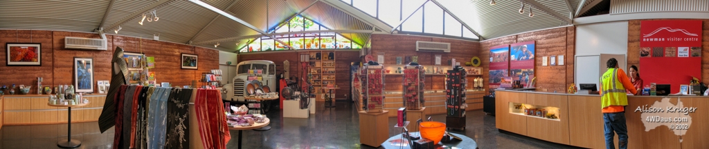
Today we ventured into Newman to stock up on food, water and fuel. The visitor’s information centre was nice and we booked ourselves onto a tour of the Newman mine for Wednesday 8.30am.
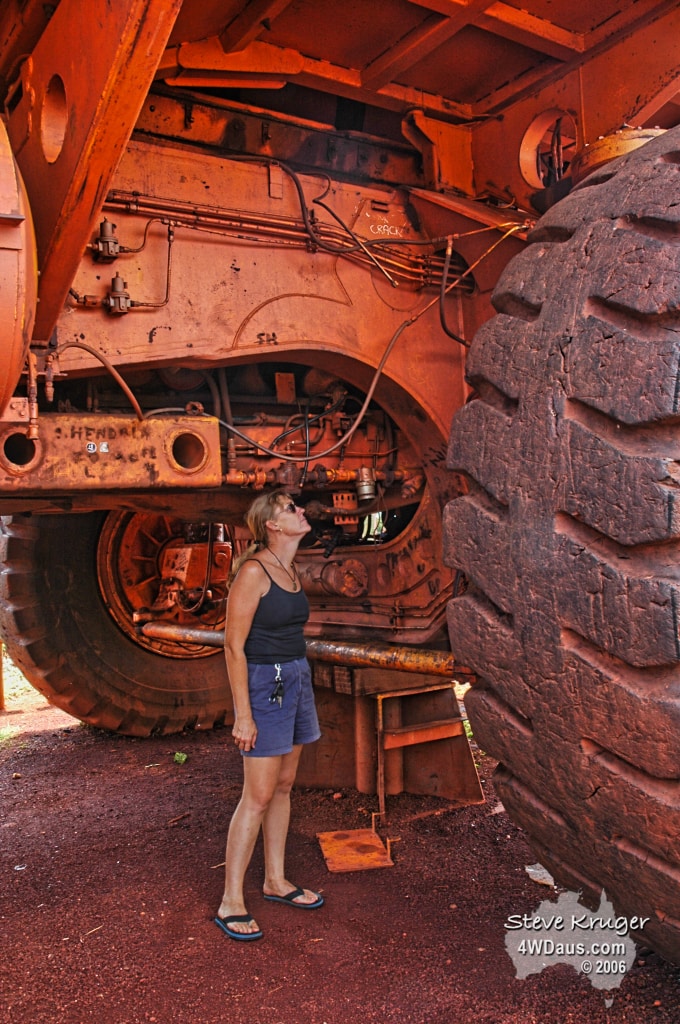
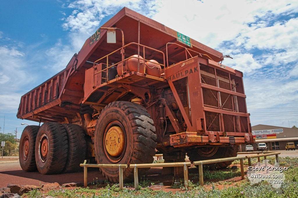
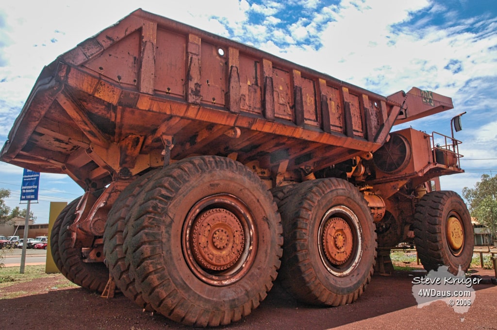
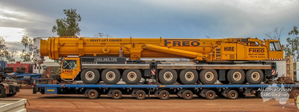
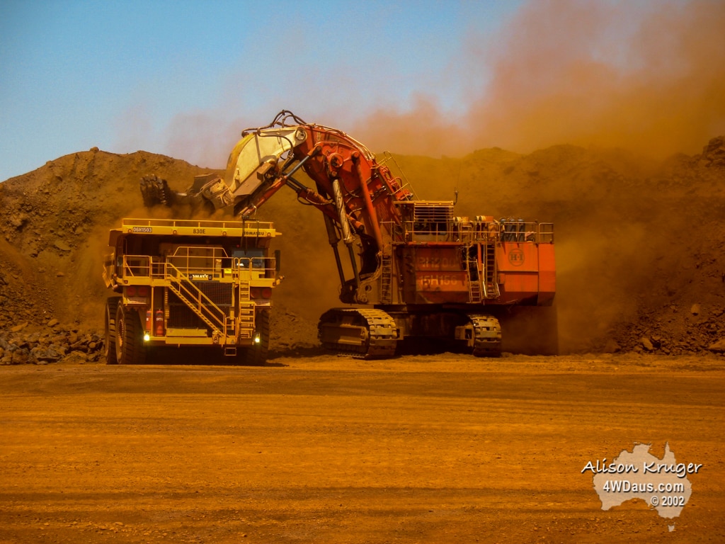
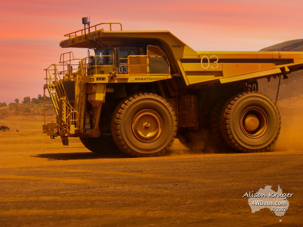
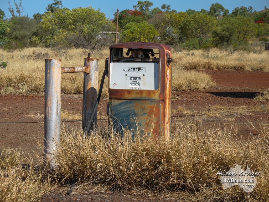
The rest of the day was spent taking it easy, and doing the “tourist thing”. We found some huge machinery associated with the mining industry to look at, including the dump truck and crane pictured below!
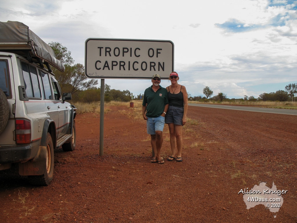
Looking at a local map it occurred to us that we were very close to the Tropic of Capricorn and that the Capricorn Roadhouse was not named after a star sign. So we turned the vehicle southwards the 15kms and found the Tropic of Capricorn, an unassuming sign!
Then we drove a little further and found the Capricorn Roadhouse. Alison managed to get this great picture of Graham, the owner of Capricorn hard at work.
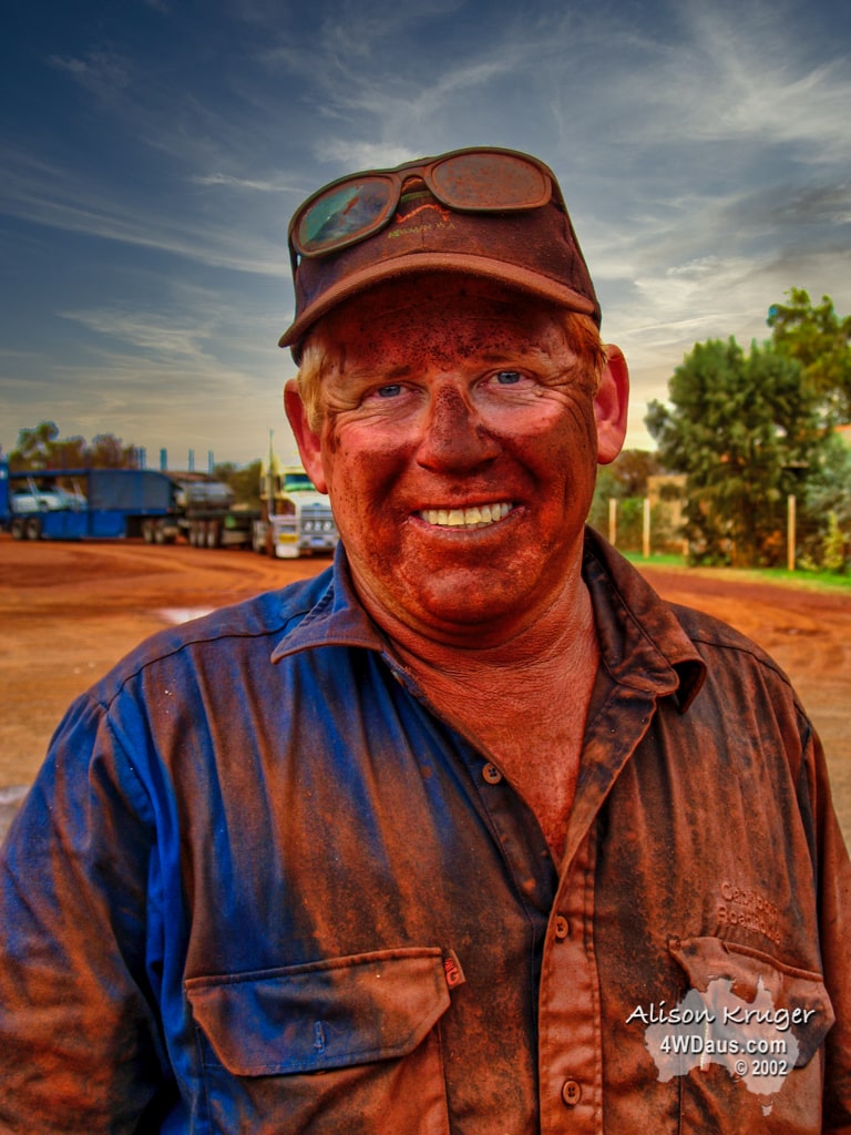
He really typified to us the typical Aussie getting on with it and not afraid of getting his hands dirty, (or the rest of him! )Turned out the roadhouse also had a tavern and restaurant attached to it, so it was time for a drink and a meal. A great evening and thank you to Libby, Graham’s wife for some nice conversation, and hospitality.
Day 86 Wednesday 25 October 2006
Last night we slept on a hillside outside of Newman, overlooking one of the mining operations, some 590m above sea level. It was amazing watching the big vehicles moving about in the artificially lit environment. The weather change that had come through had dropped temperatures dramatically. This morning it was only 21c and we didn’t complain that we needed to wear full length pants and tops and shoes today for the tour, as it actually kept us warm. Sadly, the Tourist Centre cancelled our tour as we were one person short of the minimum number for it to run, even though we offered to pay for the extra seat for it to go ahead. So our attention then turned to finding an internet connection to up load the previous week’s web update. In a town this size there isn’t a place where you can plug your laptop in or go wireless except for a caravan park we managed to find. Unfortunately’ they only sold internet time in lots of 24 hours. We decided this was going to be a lost cause so we hit the road in search of our next destination.
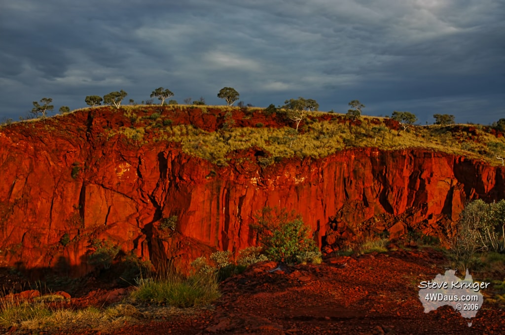
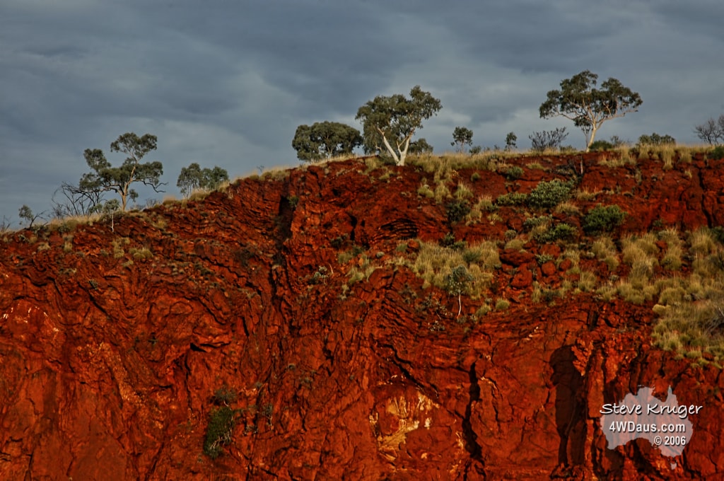
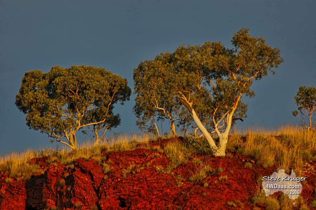
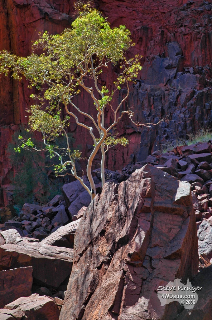
The tourist centre had warned us that the drive into Eagle Rock Falls was only for the very experienced 4WD and so we decided to try it. The drive in was worth it and we found a very beautiful spot to camp for the night on the top of the gorge looking down the valley for many kilometres. As the day has been very overcast, our photography has been a lot quieter and we hope to see the sun on Thursday
Eagle Rock Falls is actually 2 waterfalls of 12m and 60m respectively, and it had a small amount of water flowing over it. The cliffs about it have some snappy gum trees on them which are a beautiful white colour. Lucky for us we managed to have 4 minutes of setting sun in which to get some photo.
Day 87 Thursday 26 October 2006
We both had good night’s sleep last night. No storms, no noisy mines or motor vehicles to interrupt the bush quietness of frogs, crickets and waterfalls. After the cloudy day yesterday, we decided to stay today. Of course this meant we could scale day the gorge walls to the bases of the two waterfalls and do some more photography. Although the climb down was a bit strenuous, the floor of the gorge and the pools at the bottom of the falls made up for it. There was only a trickle going over the falls and the pools of water were a very green appearance, which made a still environment suitable for reflection shots. After spending an hour or so down in the gorge we clawed our way back up to our camp site and had some lunch.
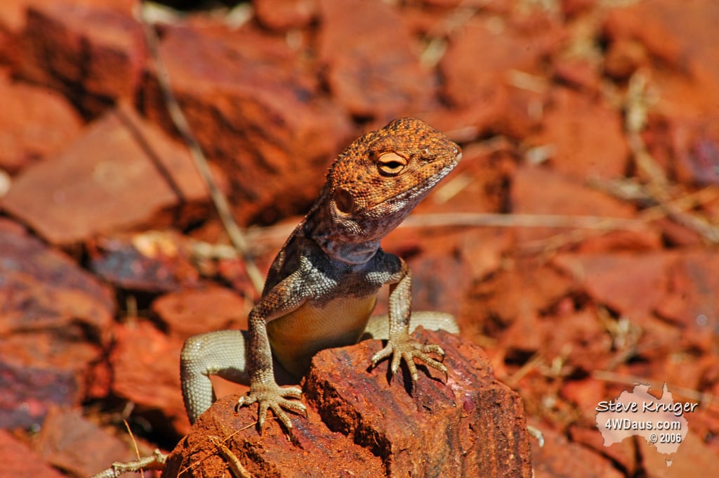
Around our campsite there are the most gorgeous lizards which scamper across the rocks so quickly. Their colourings are unique to each and well suited to the environment. We have come across these lizards quite a few times in these more arid, stony regions.
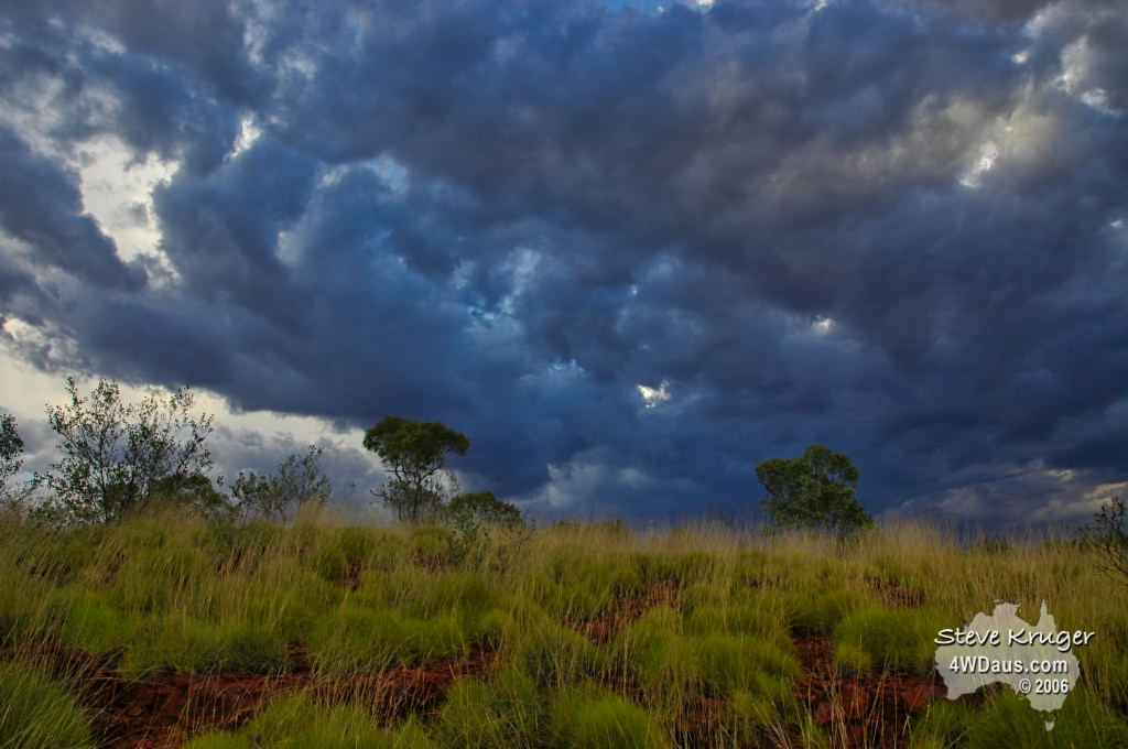
As the afternoon progressed the storm clouds came back in on us, which made for some interesting photographs. We received a little rain, but mostly thunder and lightning. The only thing that ever concerns us about these storms is the wind levels. This storm was pretty placid…more bark than bite. However they are good experience for refining our setup for some of the summer storms we may encounter in the coming months.
Day 88 Friday 27 October 2006
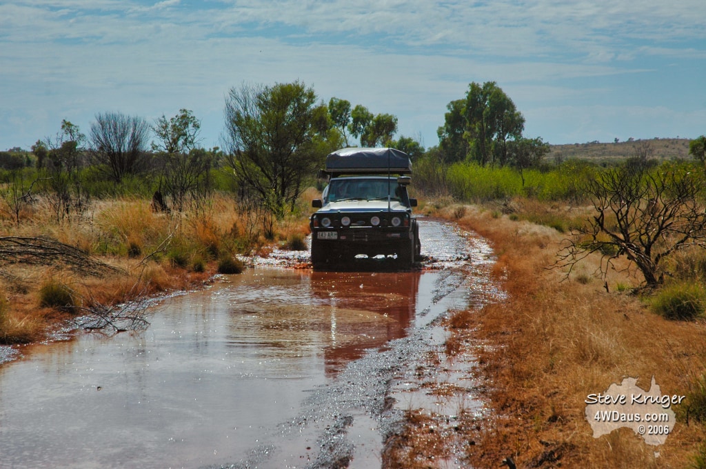
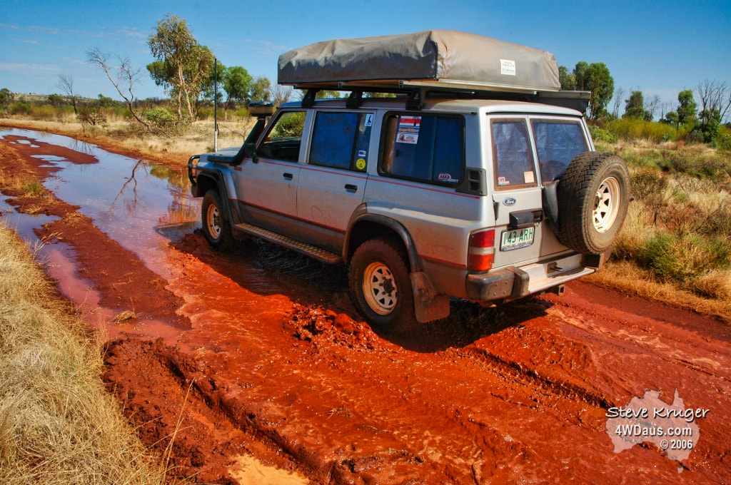
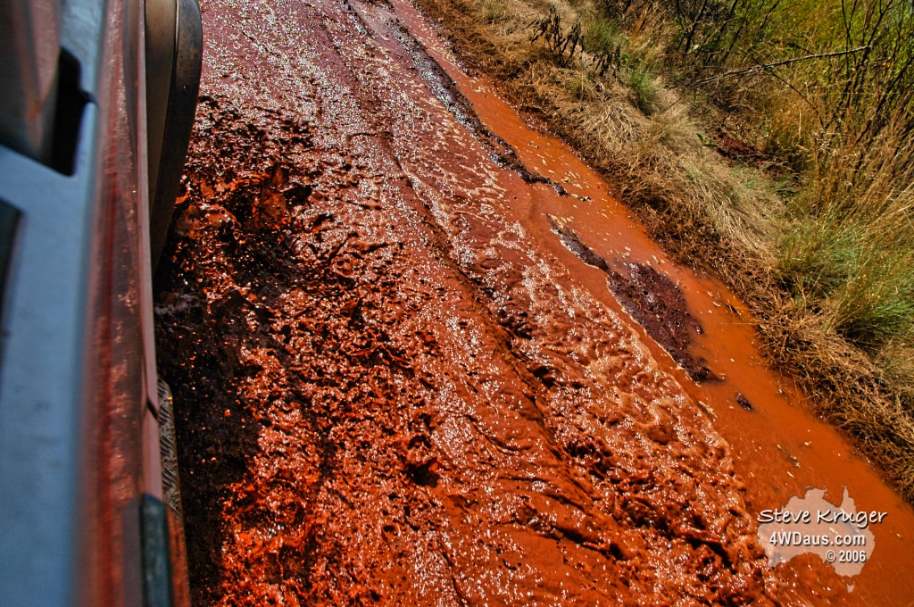
Another good night’s sleep (the cooler weather here is so much better for sleeping) before we broke camp and headed towards Tom Price. We were a little surprised by how much rain had fallen only a few kilometres from where we camped, and the road had become water traps. We stopped and had a chat with a road grader operator who told us we should stick to the middle of the tracks as in this area the edges have the nasty habit of collapsing, trapping unsuspecting vehicles. As we moved along the watercourses, the water was a rich red colour. Further churned up by our tyres, it splashed up and coloured our vehicle. Not since Cooktown has the vehicle seen so much water on the track. (or so much mud!!)
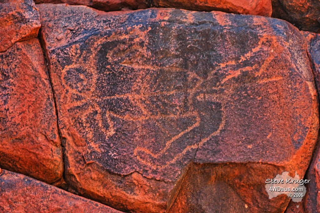
Our next stop was at the Wunna Munna, which is known for its Aboriginal rock carvings. These rock carvings, or petroglyphs, were on the cliffs surrounding a pleasantly shaded waterhole. If you look carefully you can see a kangaroo engraved into the rock. This engraving was approximately 1.5 to 2 feet high. This was one of many carved into the rocks. The more you looked, and with the changing lights, the more of these carvings we found. Although not as spectacular as the rock art of Kakadu, or Keep River NP, it was quite amazing knowing that these engravings date back as much as 26,000 years!!!!
After an hour or so of exploring we headed off towards Tom Price. On the way we decided to do the 4wd trip to the top of Mt Meharry. At 1253m, Mt Meharry is the highest mountain in WA beating Mt Bruce by a mere 18m. (An interesting point here is that due to a surveyors calculation error, it was not until recently that it was discovered that Mt Meharry was the higher peak.)
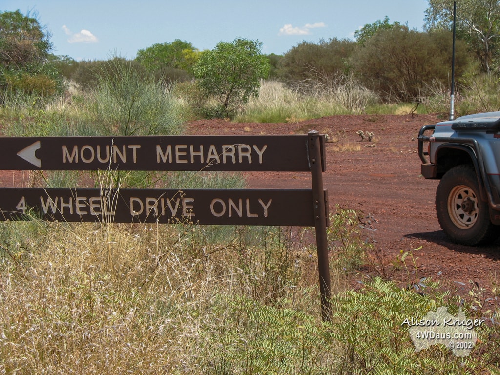
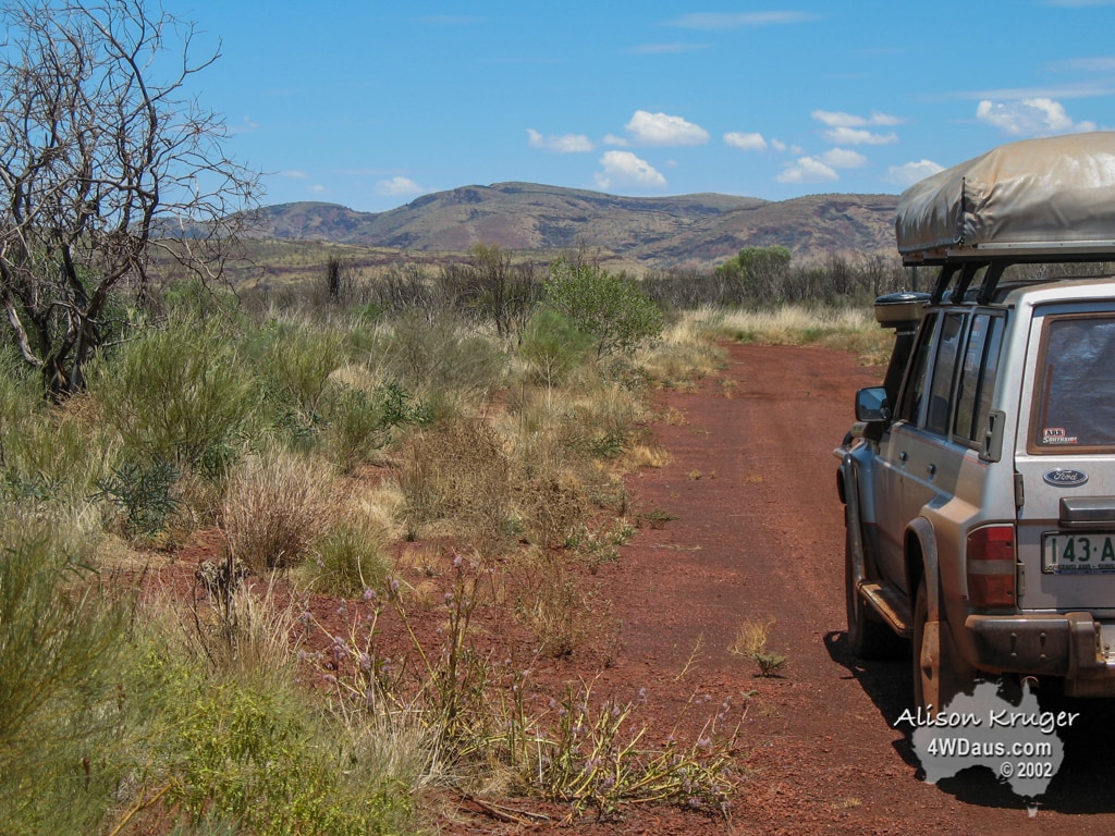
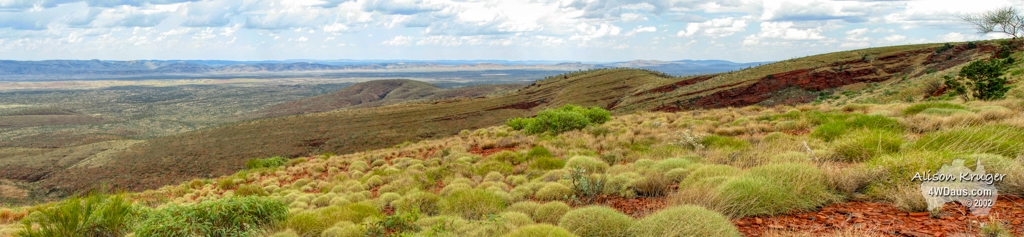
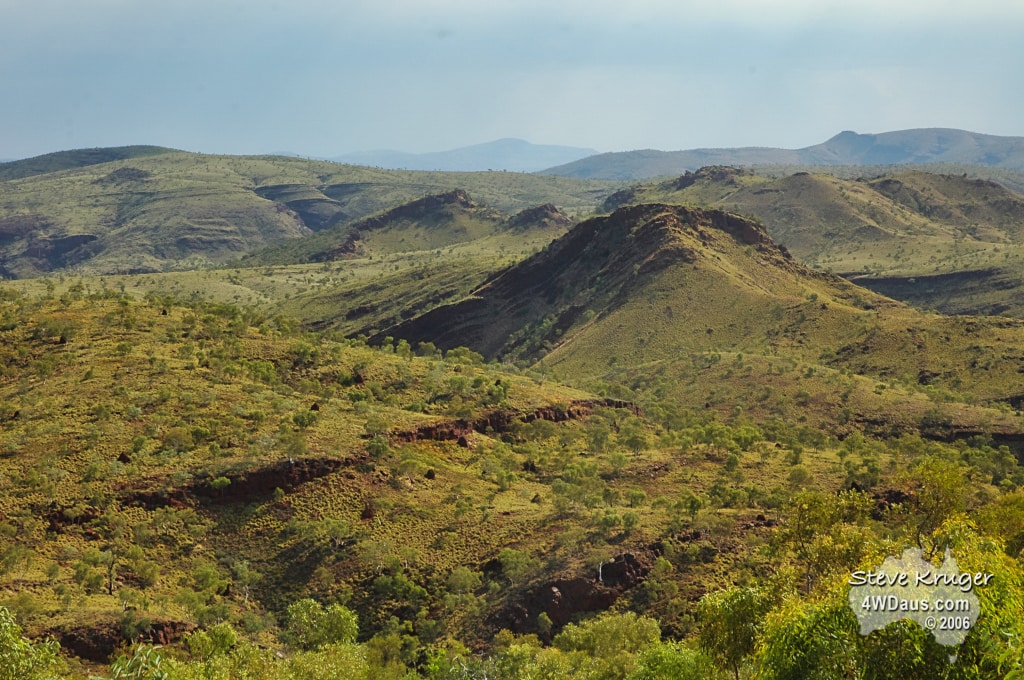
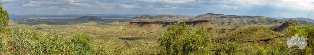
Mt Meharry is on the western edge of Karijini National Park, in the heart of the Hamersley range. The track to the top can be accessed from a number of different directions. We came in off the Great Northern Highway, along the Juno Downs Rd. This track was in reasonable condition, with only a few ruts and gutters to contend with. The track up the side of the mountain was quite steep and shaly, while following a number of ridgelines. The last 400m in height was completed in 2 stages over a distance of 2800m – that had us going up at an average of 1:7 or 12.85 degrees over the distance, but believe us, there were sections steeper than the average as you actually go down hill to get between the 2 climb sections! Once we reached the summit, we were rewarded with 360 degree views of the surrounding plains and mountain ranges that unfolded before us. They seemed to go on forever. We stopped here for lunch, and the usual photo session, then headed back down the mountain to continue on to Tom Price.
We arrived in Tom Price on the tail of a thunderstorm. We went to the Post Office to pick up our mail that had been forwarded to us, and headed off to the local swimming pool to catch up with Ray Martin who we met through this web page. (Ray is the manager of the pool).
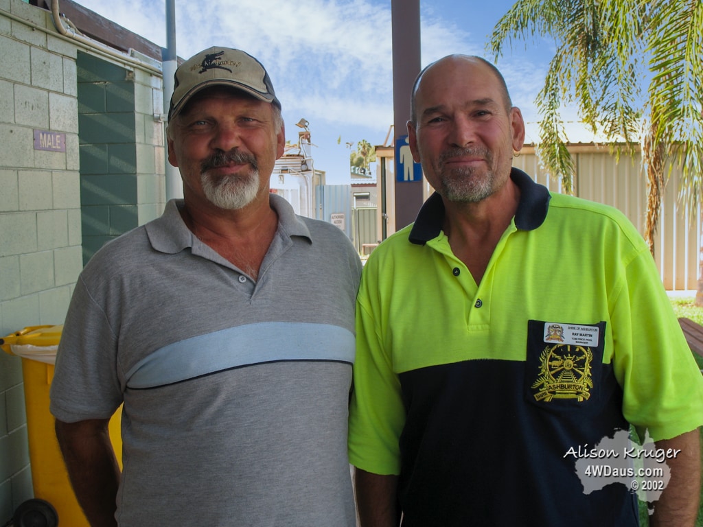
After a pleasant chat with Ray, getting the lowdown on all the good things to see in Tom Price, we booked into the Tom Price Caravan Park for the night, and headed out for a meal. Ray had recommended the cafeteria at the Karijini Lodge, where we had an all you can eat Buffet for a very reasonable price. Needless to say we felt full and satisfied by the time we left!!!!
Day 89 Saturday 28 October 2006
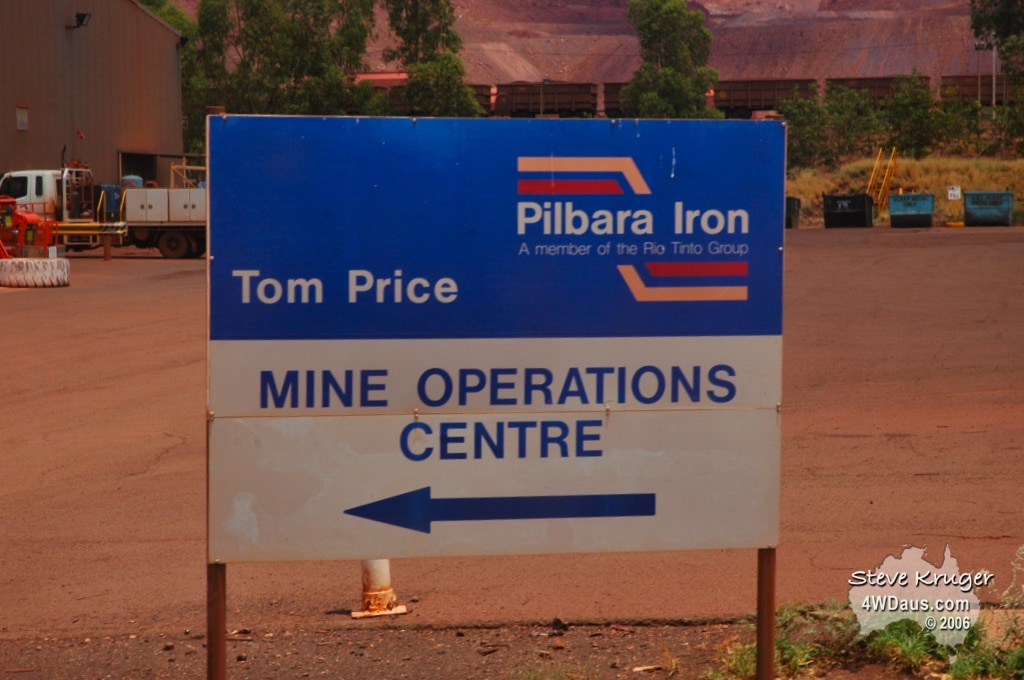
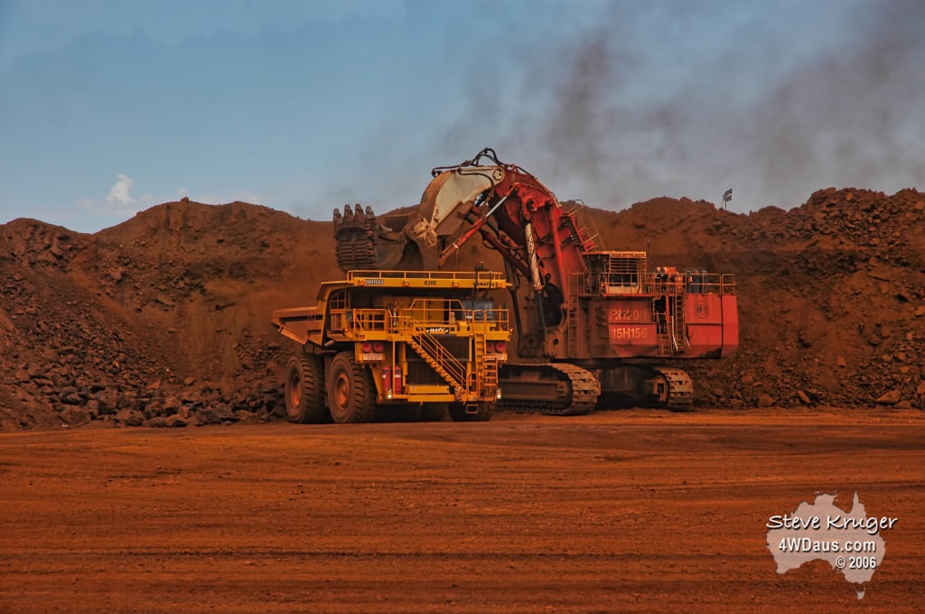
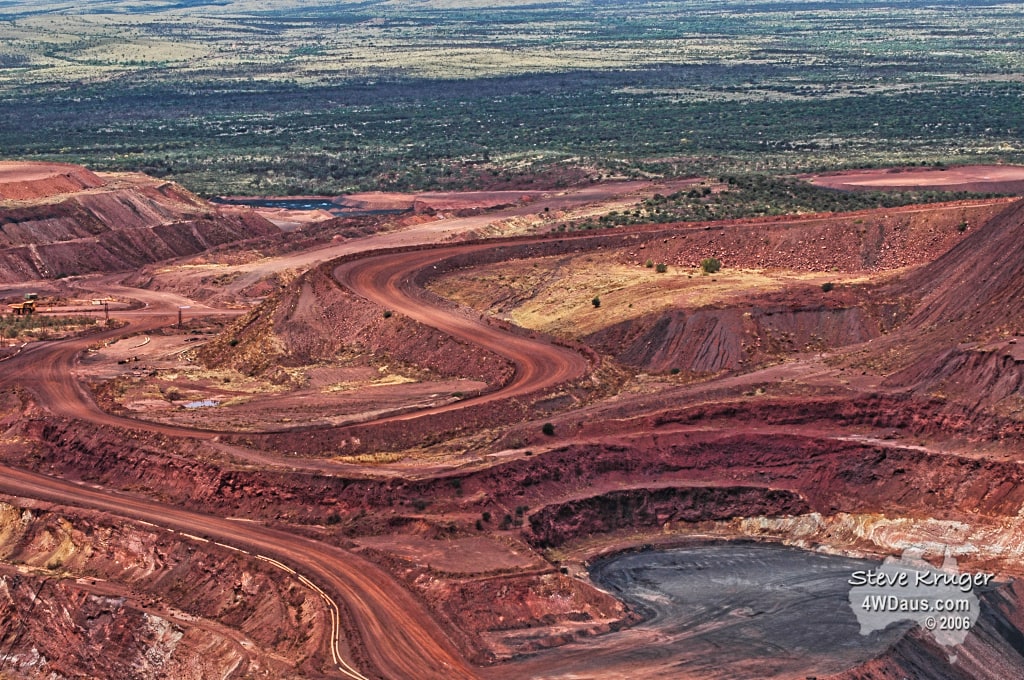
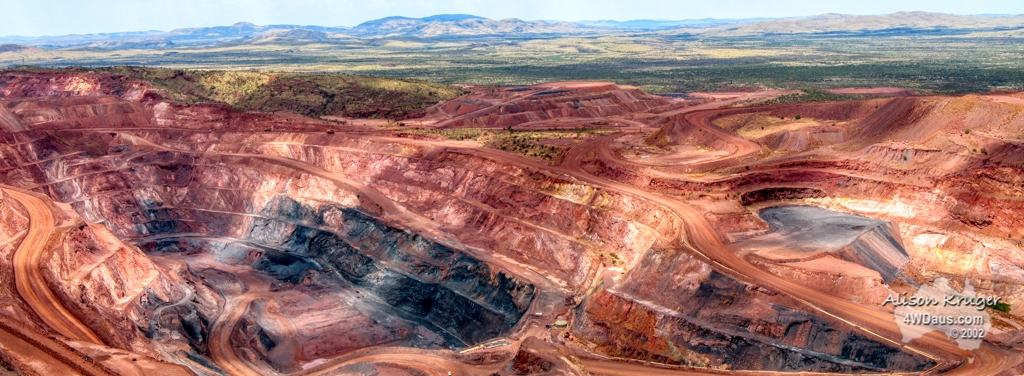
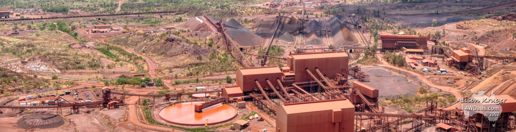
We had an exciting day planned, with a mine tour of Pilbara Iron, if there were sufficient numbers of other people planning to do the same thing. When we arrived at the Visitors Centre, to our relief there we 30 other people lined up, one of their busier days. We were equipped with hard hats and protective glasses and loaded onto a bus. Our driver announced we were heading to “Tonka Land” and it certainly was! Pilbara Iron is an open cut mine which is basically demolishing Mt Tom Price. The mine tour cost $19 and was a little over 2 hours. The time certainly flew and we had great fun getting some of these photos together.
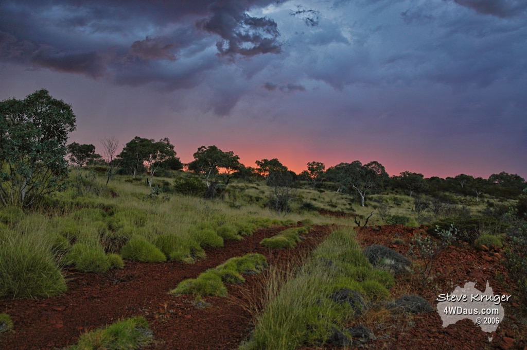
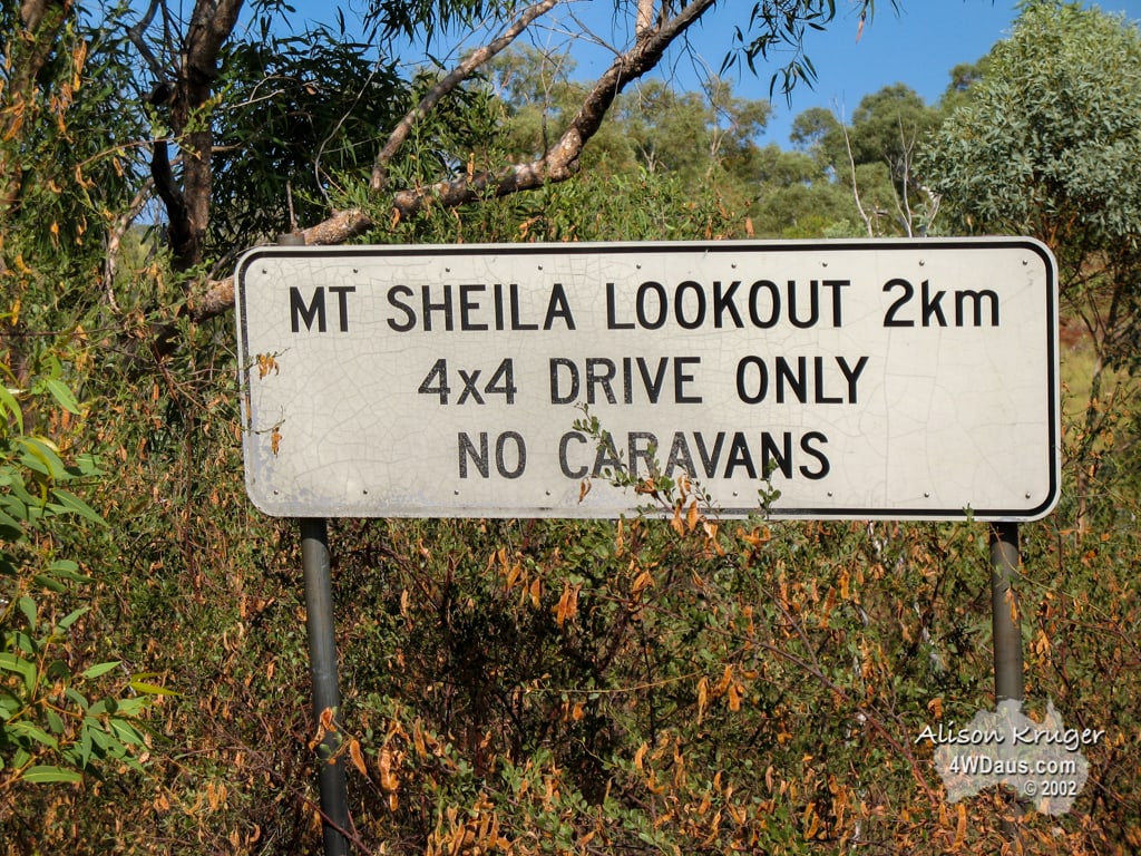
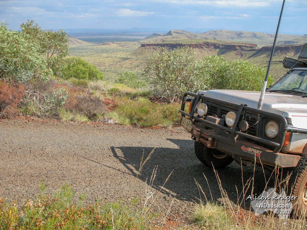
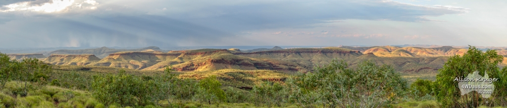
After such an exciting morning we decided to head back out of Tom Price for Mt Sheila, so we could have an early morning start for Hamersley Gorge. Mt Sheila was a complete unknown to us as we just found the lookout on a map and decided to head there. The road in was steep and the views were 360 degrees! A big effort with big rewards. We decided to camp there for the night as well and we managed to setup and have dinner cooked just as the heavens let loose with another storm. This confirms what we have been told that the wet season had arrived 6 weeks early.
Day 90 Sunday 29 October 2006
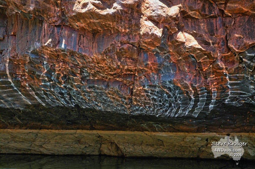
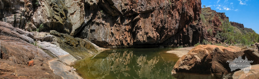
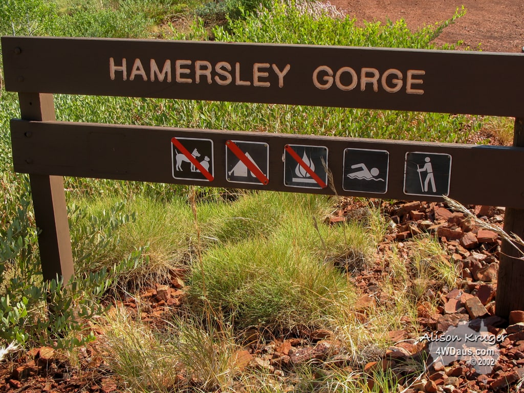
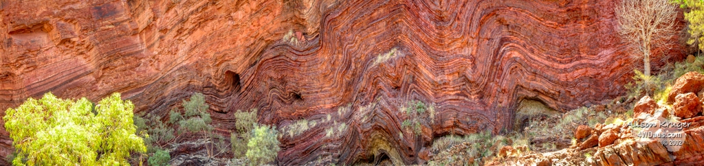
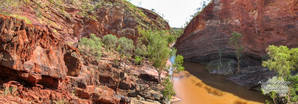
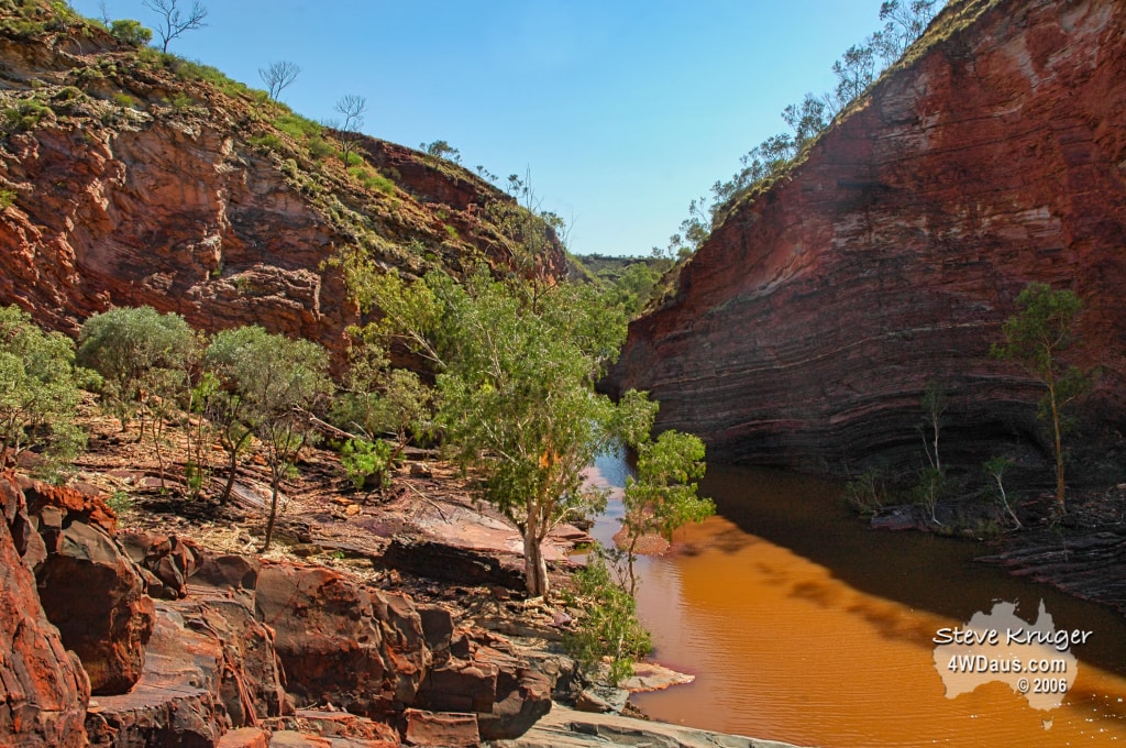
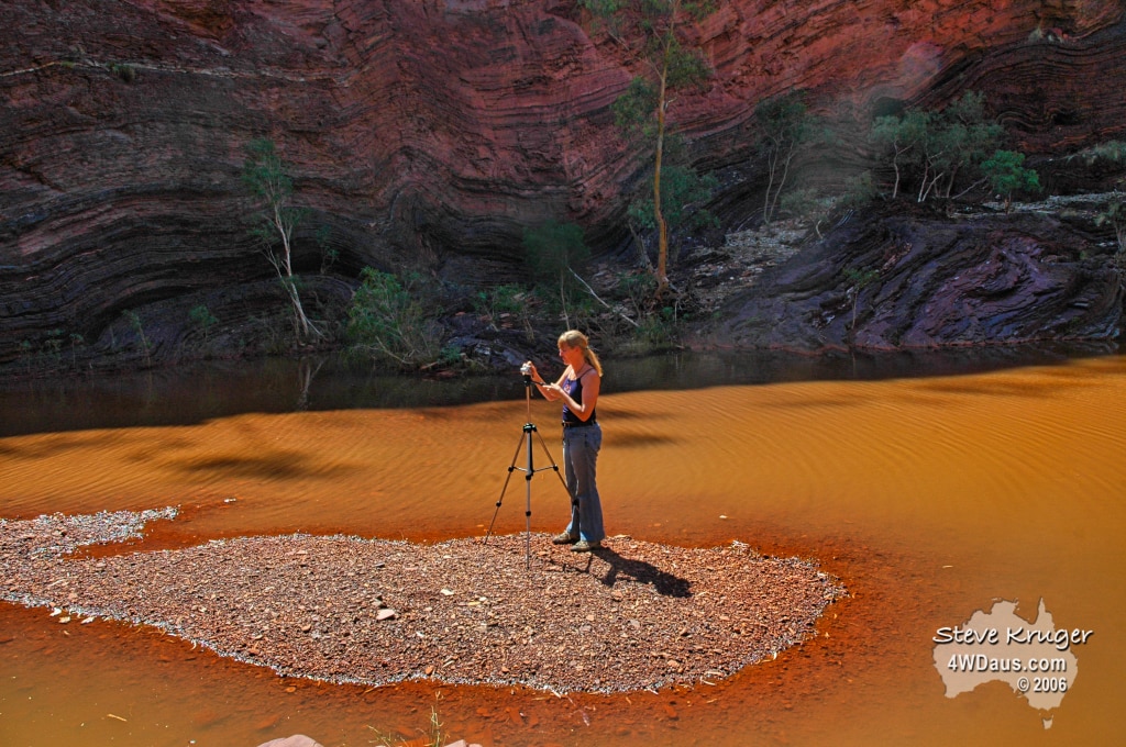
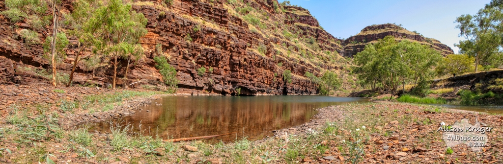
This morning we woke to a flat tyre. We had wondered why the bed felt at an angle during the night after we had taken so much time to ensure we were parked in a horizontal position. Answer a flat tyre! A splinter of iron ore had penetrated the tyre and was an easy fix with a plug. With the tyre repaired we headed to Hamersley Gorge. This gorge is part of the Karijini National Park, formally known as Hamersley National Park. It was only a short walk from the car park down into the gorge, and the rock formations were quiet fascinating. We don’t think the water in the gorge is the brown colour you see in the photos normally, but the result of the local rain we have been experiencing. The other thing which surprised us was the brightness and quantity of purple rock in the gorge.
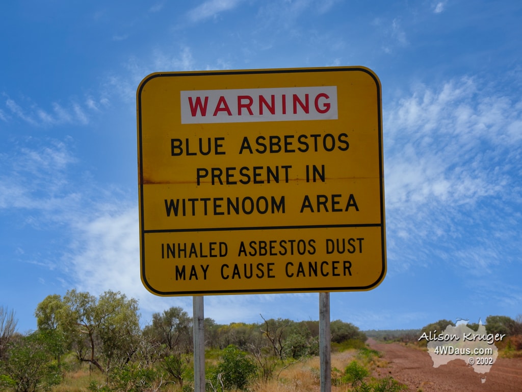
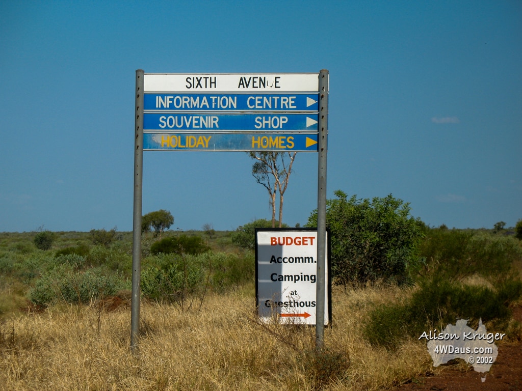
Our next stop of the day was the Wittenoon Township and gorge. This is an area famous more for controversy than the beauty of the gorge and its water holes. Sadly the township is dying, kept alive by a dedicated few, but the rumours are the WA Government will close access to the area for good in the next year or so.
Day 91 Monday 30 October 2006
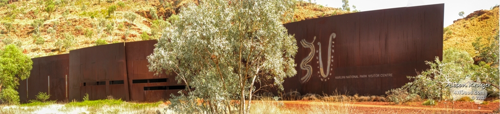
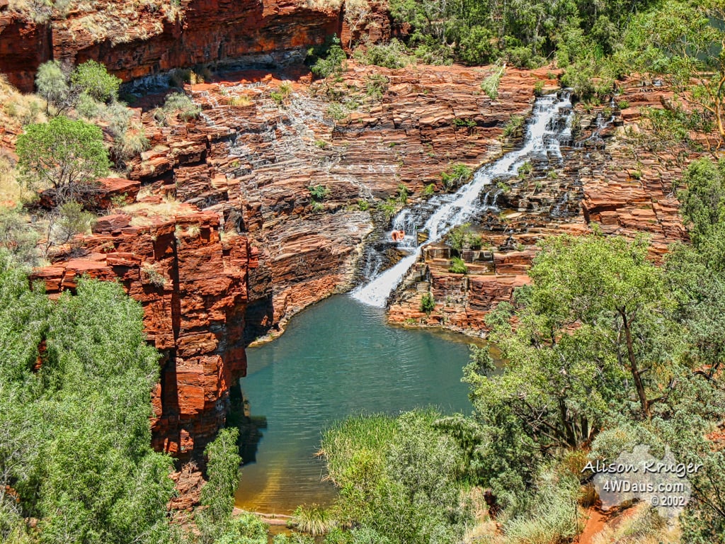
Today we entered Karijini NP to see their visitor’s centre and Dales Gorge area before we headed back to Tom Price to say good bye to Ray. The Karijini Visitors Centre has won awards for its design, and is very unique in its style and feel. The use of oxidised iron matches the escarpments that surround it. The first lookout we reached was Dales Gorge, which overlooks Circular Pool. Many metres below us we could see people having a great time in the clear waters. We were not enthused enough for a morning hike, so ruled out the walk down there to join in on a swim! A short drive from there was Fortescue Falls. These falls cascade over many natural stairs into a pool. It was a short walk down into the Gorge to the falls, and it’s a popular spot for people to enjoy a cooling dip in the pool at the bottom of these spring fed permanent falls.
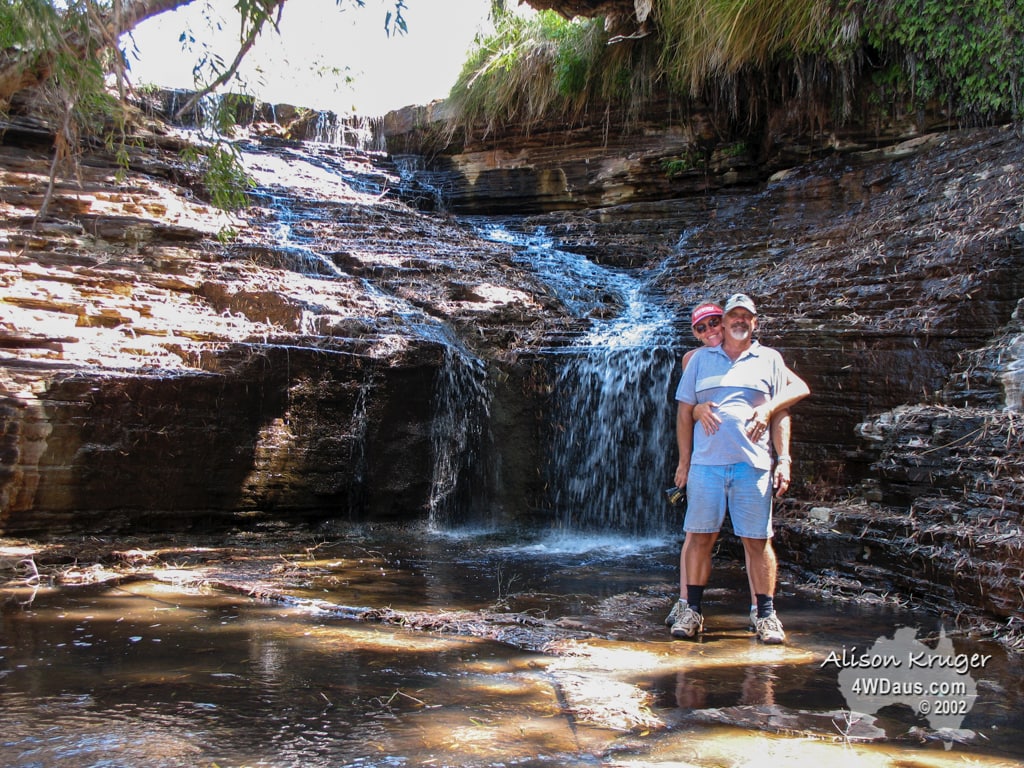
From here we headed 29kms to Kalamina Falls. These falls were not huge or spectacular as the earlier falls, but the lower light conditions were ideal for us the play with the time exposure on some shots with some pleasing results. Yes our model does get a little wet here which seems to be the tradition!
After a quick trip to Tom Price we headed back to Karijini to find a spot to settle down for the evening. The storms which had been building all day finally decided to dropped their rain and in a big way. Sadly for us, this meant cheese sandwiches for dinner!


Stay tuned as the adventure continues……