Week 12 Sandfire, 80 Mile Beach, De Grey River, Port Headland, Kitty Gap, Coppin Gorge, Marble Bar, Carawine Gorge
Day 78 Tuesday 17 October 2006
The drive between Broome and 80 mile beach lacks any major scenery. The scrub that lines the road is no taller than 2-3m and vantage points are few and far between. We hit the road this morning at 7.30 with the temperature 30.5c. At times yesterday the air conditioning struggled with the cabin temperature topping 38c, so today we have run the air conditioning from the word go. To assist the inside temperature we have also blocked out all windows in the vehicle except the passengers, drivers door and main windscreen. It was certainly a help and we cringe at the thought of how hot it would have been without us taking those measures.
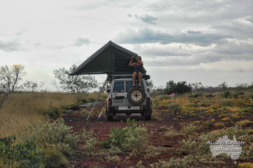
First stop today was the Sandfire Roadhouse. Not much here except a roadhouse of course! Still it was a welcome excuse to stretch our legs, buy a favoured milk (coffee flavoured of course to get the heart started) and continue our journey. You will notice that even Alison’s panoramas make a long stretch of the highway look like its an intersection!
The dirt road below is the Kidson Track, a desert track that ends up at Alice Springs.

It is not far from the turnoff to the 80 mile beach caravan park. We started down the track to find some sort of road sign to photograph, but unfortunately couldn’t find one. Both of us really wanted to follow this track through to Alice Springs, but it would mean we would not be able to do the Pilbara or Exmouth, due to the time taken and the increase in heat that is becoming increasingly noticeable. So it was with a huge amount of regret that we turned about and headed for the 80 Mile Beach.

Approximately 10kms from the start of the Kidson Track we arrived at 80 Mile Beach Caravan Park. This is the only place for 80 miles where you can access the beach and it was certainly welcome to find. Alison was excited to find out that it was Flatback Turtle nesting season at the moment (think we remembered this correctly) and was quick to identify turtle tracks on the beach. The turtles certainly left some indirect tracks across the beach to the dunes to nest. We drove for about 15kms up and down the beach and had a swim in the turquoise waters. We have read less than complimentary things about the beach, but we found it on a truly beautiful day. It was a weird feeling seeing heat mirages down the beach of water!


The last stop for the day was the abandoned Goldsworthy Mine area before we continued on to De Grey River to camp the night. The red dunes and burnt out landscape were spectacular, as were the mountains from the mines tailings, which were almost of a mathematical pattern. BHP must have a fortune in rolling stock sitting here – anyone needing a railway carriage or two?


Day 79 Wednesday 18 October 2006
Rest day on the banks of the De Grey River in the shade of gum trees and paperbarks. Small swimming water hole to pass the day by, it had a 2 inch layer of warm water over a cool substructure. Spent the day reading, snoozing, swimming and generally catching up on things. This was a good camp site, and would have been the sort of place you could stay a few days. In fact we met another couple from Queensland who had been there 11 days. They had the benefit of a solar power setup to keep their batteries charged.
Day 80 Thursday 19 October 2006
Port Headland was today’s destination. After a leisurely start we arrived at Port Headland’s Dampier Salt facility, and saw some of the largest piles of salt we have ever seen. This salt is harvested from the huge ponds to the right of the stockpile which are fed from the ocean. The large semitrailers we have become accustomed to, then transport the salt to wharves for export. An interesting fact we learnt was that only a very small percentage of the salt produced ends up as table salt. The majority is used for industrial purposes.


The next stop was Spoil Bank (beach), where we engaged 4WD to negotiate the soft sand. This area is set right next to the shipping lane and to our delight, the tug boat guys had just hooked up the Cape Jupiter to bring her into port. It was incredible the speed these huge freighters are pushed around the marker buoys and into port, they make it look so simple. As you can easily see this vessel is riding very high in the water as it is empty and will be loaded with 176,000 tonnes of iron ore which will be exported to China, scheduled to depart 8am tomorrow.


After a quick swing through town it was back to the pub for a counter lunch. A certain lady locked our keys in the car and was helped by 2 guys with a coat hanger, thanks guys! After some more sight seeing it was back to the Spoil Bank for the sunset, with the port as a back drop. Judge it for yourself below!


Day 81 Friday 20 October 2006
After a leisurely morning of taking more pictures, some shopping and a fuel up, it was good bye to Port Headland and on the road towards Marble Bar.

Our first tourist stop for the day was Doonela Gorge. Access was easy and with our 4WD we could access right up to the gorge itself with out any walking! (BONUS) One plus with some gorges are they offer shade in close, and Doonela didn’t disappoint. If it had not been so early in the day, we would have camped here, as it is beautiful in a desolate fashion.


Our next stop was Coppin Gorge and Kitty Gap, off Bamboo Creek Road, just west of Marble Bar. The tracks around here are the reason we love to 4WD and why we enjoy it so much. The road through Kitty Gap is little more than a track up the creek bed which the mining companies put in. Its rough and slow going, but the rewards are in getting access to places most Australian’s will never see and having it pretty much to yourself. Coppin Gorge was incredible; the patterns in the rocks you would think were man made. There is one current mining project on the go here named the Spinifex Project and you can see the results of their test drillings all over the area. We headed to a test site for the night which was half way up the mountainside, and which gave fantastic views of the valley and Kitty’s Gap. To try and catch the sunset at its best we scaled the mountainside up to the summit. Wow does that Spinifex grass hurt!


As the sun disappeared we noticed a glow starting on the other side of Kitty’s Gap which at first we thought was the lights of a car. The intensity steadily grew until we knew it was a fire. We were up wind from the fire, and in no danger, so we decided to monitor it and investigate it some more in the morning.

Day 82 Saturday 21 October 2006
First up today was to go and see how far away the fire actually was, and to find out how at night the distance of fire can be very misleading. As the crow flies it was 5kms and the other side of a gap to where the fire was still burning. The smell of Spinifex burning is almost like oil and you can see the smoke it gives off is very black.


About 9am we arrived at Marble Bar. The town was named after the huge rock bar that cuts across the local river. And the rock bar was made of Jasper. Yep another one of those great muck up stories in history, not marble at all! Any way we played tourist for the morning before heading to the Comet Mine about 7km west. From the mine we worked ourselves along a disused track to an abandoned WWII airstrip. Not a great deal to see and believe it or not we could not find one picture to take of the area. Still is was interesting to see the area of the base and what the people who served there would have needed to endure. The final stop for the day was Carawine Gorge. Now, we expected the usual run of the mill gorge, as we have seen plenty!

We were pleasantly surprised to find a huge gorge that was close to a kilometre long, and so we camped beside it – it was awesome. The cyclonic floods 2 years ago stripped away much of the gum and paperbark trees which shaded this site previously. The remaining trees were damaged and stressed. However it was still a worthwhile sight to see. Carawine Gorge is on the Oakover River.

We had seen a navy blue series 80 at Kitty’s Gap yesterday which drove into the gorge when we were setting up camp. This belonged to Peter and Anna from Hungary who are on a 6 month drive tour of Australia, followed by 3 months in New Zealand. Now the strange thing was that when we first looked at the car it didn’t look right, then suddenly it clicked – it was a left hand drive. They had bought their 4WD with them from Hungary!!! It was a very enjoyable evening chatting to Peter and Anna and we hope to bump into them again at some point further down the coast. This was the 3rd or 4th trip that Peter & Anna have done to Australia, and they probably have explored more of this country than most Australians, especially the outback.


Day 83 Sunday 22 October 2006
Up early this morning and said our good byes to Peter and Anna before we headed off to Upper Carawine Gorge. We could not find the access track so we continued on to Running Waters Waterhole. The water here was crystal clear and you could see fish and any snags which would normally be hidden from view. This demanded a swim and we had 2. The photo opportunities were also fantastic here and we have been very pleased with the results. And yes that is Alison in the river with tripod and camera and yes she does sleep with them too! (Just kidding…maybe)


By midafternoon we decided that with the weather closing in, we would prefer a little less closed in camping site and so headed off to Upper Carawine Gorge – through a different route. We were ecstatic with the view and the scenery we saw along this track that we had almost missed out on. The mesas and tent mountain formations reminded us very much of pictures we have seen of Arizona in the States, except it looked greener thanks to the Spinifex Grass.


Day 84 Monday 22 October 2006
Last night you could see and hear the electrical storms circling us like Indians rounding up the Cavalry. Nothing came of it except its certainly cooled down the thick hot day very quickly. It was 30c when we hit the sack, a temperature we generally wake up to.


The subject of today was mine sites – all disused. We met Tony at a disused mine site named All Nations. He has lived there close to 20 years and swears he just loves the peace and quiet. Still, he also loves to chat and it was nice hearing some of his stories for 1/2 hour or so.
We visited the old State Battery and Barton’s Battery to mention a few. This area is riddled with old mines and new exploration sites. There are also many uncovered mine shafts, so you also need to be a little careful when you’re exploring.
4pm today we headed for a mountain to watch the storms that were building, some 500m above sea level. The views were spectacular. We had the wind at our backs so we had hoped the storms were heading away from us. WRONG! From our vantage point we could see the dust storms surging across the plains towards us.


6pm They hit with the with the power of a wave pounding the coastline dropping the temperature from 39c to 25c in a matter of minutes. The sun had been blocked from view for some time and it had slipped below the horizon unnoticed. Once the swirling winds had finished with us, serving up a diet of dust, grass particles and seeds, the near horizontal rain commenced. About 7pm the scene became quiet again, but the electrical show was on! For hours the lightning struck the ground and in one spot a fire became obvious in the pitch black darkness. Sheet lightening also highlighted the immense clouds around us. The rest of the night was spent listening to the light rain on our canvas intermixed with gusts of winds.


Stay tuned as the adventure continues……